Extreme temperatures risk – City of Turin (Italy)
| Alternative: Extreme temperatures risk in the city of Turin (Italy) |
| SDG: Climate Action |
|
Indicator: Mean near surface temperature deviation (urban) (ESS code: 13_30) Close UN indicator: 13.1.1 |
Copernicus components that will be used:   |
| Area description: Turin (45°6′ 58′′ N and 7°44′ 33′′ E) is located in the north-west part of Italy, and it is the fourth largest Italian urban area with a population of 852.223 inhabitants. The city is located 800 ft above sea level and despite the climate predominantly being characterised by dry summers and mild wet winters (Mediterranean), the presence of the Alpine Mountain range and the Superga hills favours a limited circulation of the foehn winds, conferring to Turin a complex mosaic of microclimates.s |
| Rationale: In a scenario of no or limited adaptation to climate change, extreme temperatures are expected to be one of the main adverse events responsible for additional deaths (Ballester et al., 2011). The Pilot therefore intends to demonstrate the effectiveness of the proposed improvements to the current assessment framework for the SDG indicator 13_30, which is used to monitor progress towards SDG 13 “Climate Action”. To do so, the use of high-resolution climate datasets on past climate – available on Copernicus as well as on other platforms/sources – will be analysed together with health data (to determine how the application and use of diverse climate data (in terms of time and space resolution) could improve the risk assessment phase and, then, support policymakers at the urban scale. In addition, this Pilot also has interconnection with other SDGs: first SDG 3 “Good Health and Well-being”, SDG 10 (“Reduced Inequalities”), because ASLTO3 could provide health data associated to demo-socio-economic data by location (Costa et al., 2017), and SDG 11 (“Sustainable Cities and Communities”), because, with these analyses, ad hoc adaptation measures could be implemented at the local scale to increase health resilience of local population. |
| Applications: (currently not applicable) |
|
Leader: ASLTO3 Partners: CMCC |
|
Main stakeholders involved Arpa Piemonte (The Regional Agency for the Protection of the Environment) Civil Protection Turin Municipal Administration Other regional and local decision-makers in health and social policies and institutions Active citizenship University of Turin (Interuniversity Department of Regional and Urban Studies and Planning) |
| Objectives: To best define which climate indicators could be used within a risk framework that takes into account the link between temperature and health (i.e. mortality, morbidity). This will be done by taking into account the different scales of spatial resolution, but also all demographic, socio-economic and built environment components that contribute to exacerbating (or mitigating) the final population risk from extreme temperature events in urban settings. |
|
Expected results & outcomes: The Pilot will deliver a Copernicus-based tool distributing maps of the mean near-surface temperature deviation, but more importantly of risk estimates, based on the multiple climate datasets. A DSS will allow users to query the maps and analyse data, including comparing different periods. The outcome will be a better understanding whether the use of higher resolution datasets favours more accurate or different risk estimates, which can support health policy-making processes related to the temperature-related risk management of the population at the urban scale. |
| References: Ballester et al. (2011) Doi:10.1038/ncomms1360; Costa et al. (2017); De Ridder et al. (2015) Doi:10.1016/j.uclim.2015.01.001; Ellena et al. (2020) Doi:10.1186/s12940-020-00667-x; Martinez et al. (2021) ISBN 978-92-890-5540-6; Raffa et al. (2021) Doi:10.3390/data6080088 |

Explore Our Work in a New Interactive Story Map
We are excited to share a new interactive story map that presents the SDGs-EYES project in an accessible, visual format.

SDGs-EYES Final Dissemination Event: Join Us in Lecce and Online!
The SDGs-EYES project is reaching its conclusion, and for that occasion its organising the Final Dissemination Event, which will take place on 26–27 November 2025 at the CMCC Foundation’s headquarters in Lecce, Italy, and will also be accessible online.
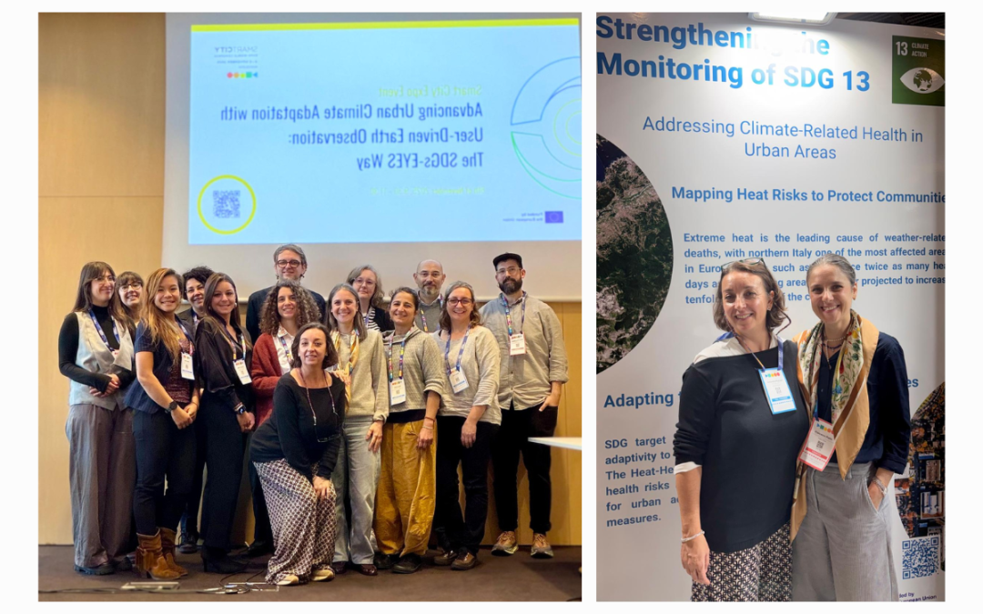
SDGs-EYES at the Smart City Expo World Congress in Barcelona
An opportunity to showcase how Earth Observation (EO) can help cities to become more resilient in the face of climate-related hazards and contribute to the monitoring of the SDG 13 Climate Action.
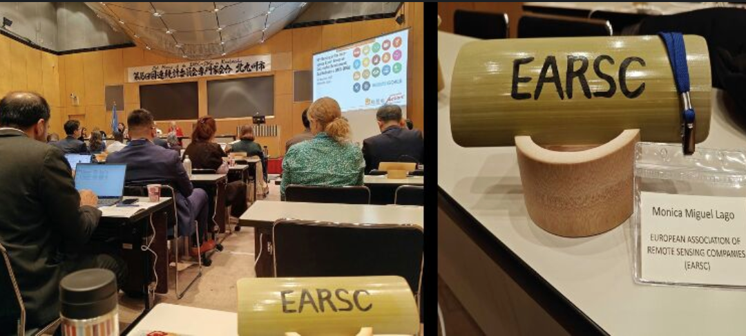
Bringing Earth Observation into SDG Monitoring: SDGs-EYES at the 16ᵗʰ IAEG-SDGs
At the 16ᵗʰ meeting of the Inter-Agency and Expert Group on SDG Indicators (IAEG-SDGs) in Kitakyushu, we presented SDGs-EYES services and demonstrated how Earth Observation (EO) can be embedded directly in SDG reporting and policy cycles.
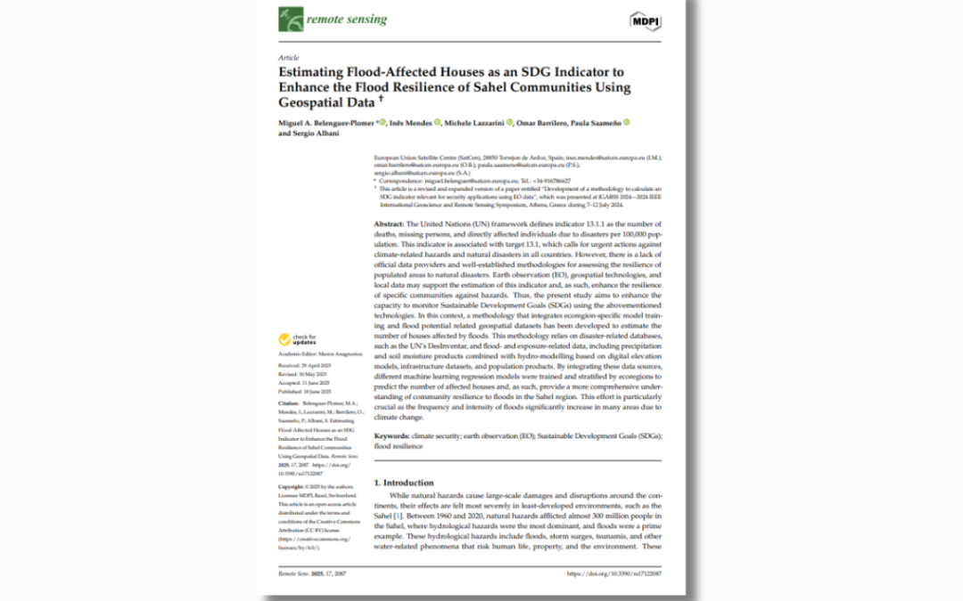
Enhancing Climate Security in the Sahel with EO-based SDG Indicators
This study presents a novel methodology to estimate flood impacts on communities, leveraging Earth observation (EO) and geospatial technologies.
Communication and dissemination strategy 3 (D6.3)
The "Communication and Dissemination Strategy 3" (D6.3) delineates the approach for disseminating and communicating the SDGs-EYES project to maximize its impact and streamline external perception. This document provides a comprehensive overview of the project's...
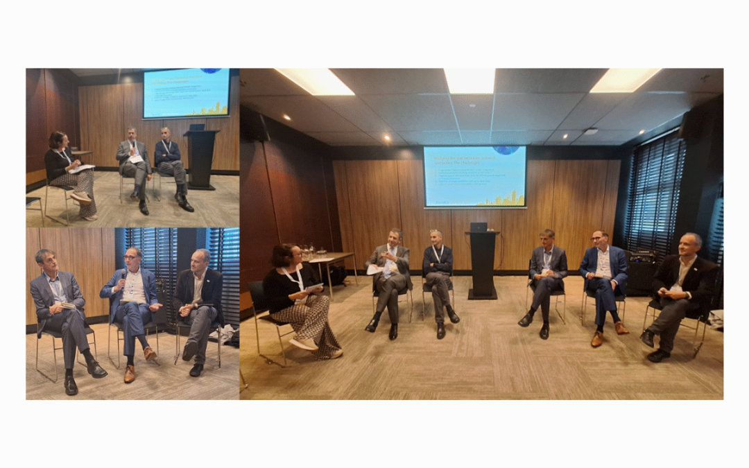
SDGs-EYEs Policy Event at EuroGEO in The Hague
This session explored how Earth Observation (EO) data can support sustainable development and protect citizens from climate-related risks such as wildfires and heatwaves.

Advancing Urban Climate Adaptation with User-Driven Earth Observation: The SDGs-EYES Way
The event provides a valuable opportunity to present and discuss the outcomes of the project in terms of developing and monitoring SDG indicators using Copernicus data.
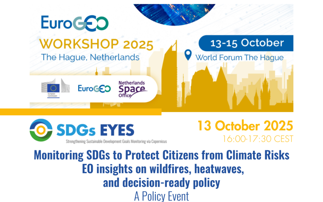
Monitoring SDGs to Protect Citizens from Climate Risks – EO Insights on Wildfires, Heatwaves, and Decision-ready Policy
SDGs-EYES is organising a policy event at the EuroGEO Workshop 2025 to explore how EO data can support sustainable development and protect citizens from climate-related risks such as wildfires and heatwaves.

SatCen Presents SDGs-EYES Pilot at BiDS 2025
SatCen will showcase its work in the SDGs-EYES project and present how research and innovation support its operational capabilities.
